
Here is your guide to hiking Bulgaria. We have covered the best Bulgaria hiking trails and all of the best Bulgarian hiking spots to take the best pics in the Balkan mountain range.
If you’re an outdoor enthusiast getting ready to discover the walking paths in Bulgaria, you will find detailed information here on exploring the country’s most beautiful gems.
For organization purposes, the guide is divided according to the four remarkable mountains of this Balkan country.
- Rila National Park
- Pirin National Park
- Vitosha Natural Park
- Emen Canyon
- Rhodope Mountains
Choose your trail and enjoy!
 One of the most popular activities and the best thing to do in Bulgaria is to go hiking. The country has stunning, beautiful nature to explore, and outdoor activities, such as hiking, are among the most rewarding.
Hiking in Bulgaria encompasses discovering jaw-dropping scenarios, expansive landscapes, impressive mountains, and a solid network of hiking trails for all levels. Some of them are very famous, such as the hikes in the Rila National Park (Seven Rila Lakes and Musala Peak) and the beautiful Sinanishko Lake in Pirin.
Skip Ahead To My Advice Here!
Map Of The Best Bulgarian Hikes
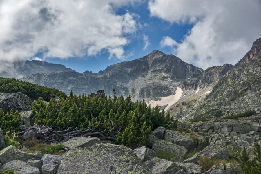
Rila National Park, Bulgaria
The largest national park in Bulgaria and one of the most impressive natural scenarios in the country, the Rila National Park is in the Southwest part of Bulgaria and is one of the largest natural parks in Europe.
Musala is Rila’s highest peak (2925 m above sea level) and one of the most visited peaks in the region.
The National Park features impressive biodiversity with over a hundred local flora and endemic species. The fauna includes reptiles, amphibians, birds, and mammals.
The usual place to stay when visiting the Rila National Park is Borovets, a vital winter resort featuring alpine hotels and winter sports facilities. Since Borovets is not far from Sofia, the capital of Bulgaria, the place tends to be crowded all year round, especially during the weekends.
1. Hiking The Musala Peak
The Musala Peak is the highest in Bulgaria and the Balkan Peninsula. At 2,925 meters, it is seven meters higher than Mount Olympus in Greece. However, it can be reasonably easy to climb, and it will reward travelers with beautiful views from the top. The area has impressive lakes, springs, and other minor peaks that add beauty to the awe-inspiring landscape.
The hiking trail is relatively flat, which is good news for non-super-skilled hikers. It starts at hut Yastrebets, which is reached by taking the cable car at Borovets.
From the start of the trail, hikers need to follow the red trail markings to the Musala hut. It is advisable to stop there and enjoy a cup of hot tea. Food or snacks are not served, so you must bring your own.
Enjoy the landscape surrounding this stop. After a while, you can then proceed up the slope. The intensity and difficulty will slowly increase in this road portion as the trail gets more complicated.
The walk, which takes 1 to 2 hours, leads hikers to the so-called Everest shelter, which marks the beginning of the climb to the mountain’s peak. This is the most challenging part of the hike, but it’s worth the effort since once on top, you will be taking a look at the world from the highest mountain in Bulgaria.
- Musala can be climbed on a day trip from the Borovets ski resort if the first part of the climb is done on the Yastrebets lift.
- The round trip from the top to Musala Peak takes 5 to 6 hours, depending on fitness level and skills.
- Those interested in climbing up the whole way from Borovets should consider an overnight stay at one of the mountain refuges.
- Lifts (also known as gondolas) do not operate when the wind is strong.
- The gondola works daily during ski season but remains closed Mon and Tue the rest of the year.
- The gondola operates on Wed to Sun from 8:30 a.m. to 6:00 p.m.. Do not miss the last gondola down because it can be a really long and tiring walk back.
- The more you ascend, the more challenging the terrain becomes, giving way to bigger rocks. Decent hiking footwear is a must!
2. Hiking The Seven Rila Lakes

The famous Seven Rila Lakes circuit is a 10-kilometer loop trail in the area of Sapareva Banya, Kyustendil, Bulgaria. It is one of the most spectacular natural landmarks in the country that receives hundreds of enthusiasts every year eager to walk the trails in the area.
Getting there is possible if you drive your car, join an organized tour, or reach the area by bus from Sofia Central Bus Station (your stop is Dupnitsa, where you must catch a second bus to Sapareva Banya). The travel time should not exceed two hours unless you miss a bus connection and must wait about 30 minutes for the next departure.
The Seven Rila Lakes trail is rated moderate but can be long and tiring if you have the wrong equipment and inadequate hiking shoes. The trail is mainly suitable for hiking, but other popular outdoor activities in the circuit include trail running and backpacking.
The lakes, which have a glacial origin, are famous for their panoramic views and crystal-clear waters. They stand between 2100 and 2500 meters above the sea, making them the highest lakes in the country.
The seven lakes are named after their distinctive features, which makes them easy to spot and distinguish. Although they are different bodies of water, all lakes are connected by streams and waterfalls.
- Lower Lake: the lowest
- Fish Lake: the shallowest
- Trefoil Lake: has the shape of a cloverleaf
- Twin Lake: two connected lakes
- Kidney Lake: has the shape of a kidney
- Eye Lake: has the shape of an oval
- Tear Lake: the clearest
The starting point of this hike is Pionerska Hut, where you can ascend via a cable car (about 30 minutes) to reach the hiking trails. Alternatively, you can also hike; the total walk is more than 2 hours long. The lift to the Seven Rila Lakes costs 18 LEV (9 euros), and the ride offers fantastic views.
Once you are ready to begin exploring, you can choose either the lower or the higher paths, both relatively easy. The higher path offers a more panoramic view of the lakes. However, they both offer advantageous scenarios.
It is essential to pack the right shoes, abundant water, a hat, and a snack. Swimming is not allowed in any of the lakes since the area is a National Park, so don’t bother packing a swimming suit.
3. Skakavista Waterfall Trek
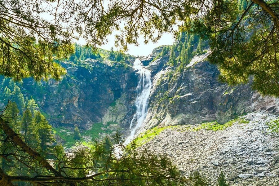
The Skakavitsa Waterfall is the highest waterfall in Rila Mountain in Bulgaria. It is located on the Skakavitsa River inside the Rila National Park. The waterfall flows dramatically down from Kabul’s eastern slope and is approximately 2,000 m above sea level, at a height of 70 meters.
The Skakavitsa Waterfall is the main tourist attraction in the area due to the century-old endemic white fir (Pinum peuce) forests surrounding it. Due to its high altitude, it freezes every winter and is at its peak in spring. When the snow melts, it turns into a thundering cataract.
Skakavitsa Waterfall is less than half an hour away from Skakavitsa Hut in Rila National Park. Take a bus or train to Dupnitsa and then a local bus to Sapareva Banya, then embark on a four-hour trek from the town to Skakavitsa via Pionerska Hut.
4. Hike To Rila Monastery
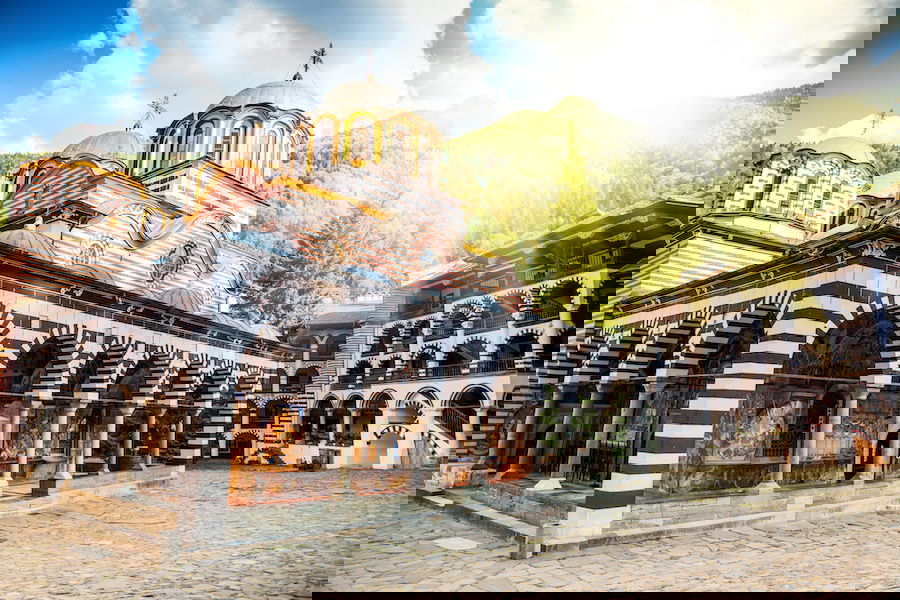
One of the best alternative activities to add to the excursion is a visit to Rila Monastery, not on the same day as you visit the lakes, because the public transport hours do not coincide to allow you to see both. Still, you can certainly stay on the next day. You can read more about this magnificent Bulgarian monastery in our guide to the most beautiful monasteries to see in the country.
5. Stob Earth Pyramids
In the foothills of the Rila Mountains, near the village of Stob and the Rila Monastery, are rock formations known as hoodoos. These rocks are often described as being cone or mushroom-like in shape, and they are covered in sunburned clay that prevents them from eroding.
The pyramids are not typical for Bulgaria, making them a unique natural landmark to visit. You can hike up to the top of the pyramids for an incredible view of the valley below. The hike is approximately 30-45 minutes to the first lookout, depending on your endurance level. The remaining climb to the top is decently steep but well worth it for the great views.
To hike the Stob Pyramids, follow signs in the village of Stob, as the GPS location takes you to a lookout instead of the hiking path.
6. Sapareva Banya
Sapareva Banya hosts some of the beautiful hot springs that make Rila Mountain famous, and they are definitely worth a visit when visiting the Seven Rila Lakes. The springs in Sapareva Banya are the hottest mineral springs in Europe; they have several healing characteristics and can be a great way to end a hiking day to treat sore muscles.
Brands We Use And Trust
Pirin National Park, Pirin Mountains
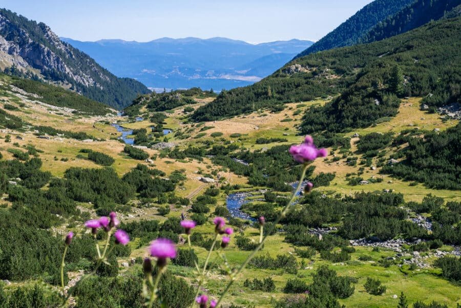
The Southwest area of Bulgaria hosts Pirin National Park on Pirin Mountain, a UNESCO World Heritage site. Slightly lower than the Rila Mountain Range, the Pirin Mountains are among the highest mountains in Bulgaria and are not easy to walk for those without enough hiking experience. Mount Vihren is the highest peak in Pirin (2914 m), the second highest peak in Bulgaria, and the third in the Balkans.
Considered one of the best national parks in Bulgaria, the area includes a diverse mountainous terrain with hundreds of different herbs, over a thousand plant varieties, and more than 500 varieties of moss and algae. Many of the park’s animals are endangered species.
5. Hiking To Sinanishko Lake
Known as the most breathtaking lake in Pirin with its unique blue surface, Sinanishko Lake is among the most popular hikes in the Bulgarian Mountains. The start of the trail is at Vihren hut.
- Walking: it is possible to hike up, adding 20 km and 4-6 hours more to the whole circuit
- Bus: the smartest option from February to September when the bus runs daily (the ticket is less than 4 euros & the trip is a bit less than an hour)
- Car: a great idea if you’re renting a car to explore Bulgaria; there are parking areas near Vihren Hut and on the side of the road. The drive is not the easiest and is mostly very narrow and steep.
- Taxi: the best way to get to the hut and quite affordable too (less than 15 euros)
The circuit takes you to the first stop, Tevno Lake, which is unfortunately underrated. Here, you can sit for a while, rest, and admire the landscape. Once there, walkers must follow signs indicating the way to Sinanitsa hut and Lake Sinanishko. The trail’s blue mark must be followed along the way.
The next stop on the way will be Muratovo Lake, about an hour after Lake Tevno. The area is incredibly beautiful but also marks the end of the easier part of the experience. Right after this lake, the trail becomes tougher, marking the most challenging part of the trail with a huge wall of moraines known as the Bunderishka Gate, which can take anything from 30 minutes to an hour to climb, depending on your skills and fitness level.
Right after this portion of the trail, there is a more relaxing flat meadow that is relatively easy to walk in, with a trail ending in the spectacular Sinanishko Gate. Visible in the area are Mount Sinanitsa, the Sinanitsa hut, and—finally—Lake Sinanishko! Remember to be careful when descending because the joy of arrival can cause you to overlook the ground and fall right before you start to enjoy this unique natural area.
6. Hiking Mount Vihren
Probably the most challenging peak to hike in the country, Mount Vihren is also a breathtaking mountain that, from the top, offers magnificent views of the region. From here, hikers follow the red markings along the way, as getting lost is not a rare event.
The trail passes endless shrubs and bushes along the way, so it is crucial to wear the right kind of hiking shoes and thick socks or long pants that protect your ankles. The terrain can, at times, be slippery, so do not disregard this aspect and travel with the right shoes.
The easiest way to hike the trail is following the King’s Way, which starts at a crossroads next to a river. The path to this trail begins to the left and is also marked in red.
The last part of the trail, the climb to the peak, is the most challenging part. Here, the terrain gets rocky but quite crumbly and unstable, so be very careful and watch every step you take.
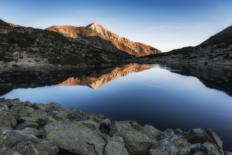
7. Hiking To Popovo Lake
Another stunning hike in the Pirin Mountains takes you to Popovo Lake, the biggest glacial lake in Pirin. The lake has crystal clear waters and is easily accessible from its starting point, Bezbog Hut.
Hikers must follow the green-marked hiking trail along a charming and easy-to-walk terrain with postcard-picture views of the region. After less than two hours, at the crossroads, hikers must take the trail to the left (downhill) and continue along the road for about one more hour to arrive at the beautiful Popovo Lake.
Vitosha Natural Park
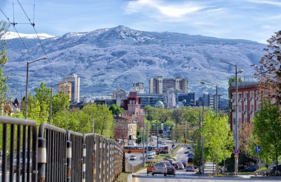
If you are a fan of hiking, Vitosha is one of the most popular places in Bulgaria and is definitely one you’ve probably already heard about.
The mountain is easy to reach from Sofia, making it a popular tourist attraction and the most visited mountain in Bulgaria. Hiking Vitosha Mountain is not hard. It is a perfect experience for beginners since it does not present such steep terrain. The peak of Vitosha is Cherni Vrah or Black Peak (2290 m), the fourth-highest mountain in Bulgaria.
8. Golden Bridges Hike
This isn’t an actual bridge built by man; it’s a natural stone bridge, and nobody really knows why or how it’s there. However, the ‘golden’ part of the name comes from the color of the moss that sits on top of the stones.
This area is also known as the Moraines, but it’s one and the same. The views from here are beautiful, and it’s an easy walk, so ideal for beginners. Some parts are a little rocky, so you’ll need suitable footwear, and it can get a little slippery after rain. However, it is a long hike, so you will need a full day to complete it.
9. Hiking The Cherni Vrah
This is the most popular and most hiked mountain in the country. It features an easy hiking path to the peak and is a comfortable short distance from Sofia.
To reach the peak, you must first get to Aleko Hut by bus or taxi. You can also drive there if you rent a vehicle during your vacation.
Aleko hut is the start of the hiking trail that climbs to the top of the mountain. The trail is easy, well-maintained, and straightforward, so there is no risk of getting lost.
The first part of the way will be the hardest, taking about an hour to complete; right after, passing an old and abandoned mountain shelter starts the easiest part of the trail, a wide, flat path that takes you to the Cherni Vrah Moraines.
The moraines are quite easy to face, and right after, it can take you no more than 20 minutes to find yourself on top of Mount Cherni Vrah.
10. Hiking To Boyana Waterfall
A beautiful place to explore in the country is the Boyana Waterfall, with several small jumps and a 15-meter fall. It is not a very high waterfall, but it is pretty powerful and noisy!
To reach the waterfalls, you must follow the trail starting at the end of Boyana Parish. Several signs indicate both the way and the trails; in fact, there are two hiking trails to the waterfalls.
The left trail is flatter and offers fantastic panoramic views over the capital. It takes about 2 hours to reach the waterfalls.
The trail on the right follows the Boyana River. It is steep, and the terrain is not easy; the views are not Sofia but a lovely, lush forest. Although it can be more demanding, it is much shorter (a bit less than an hour).
After the waterfall, the hike can be followed to reach the artificial Boyana Lake (about 40 minutes) by following the signs.
11. Hiking To Dragalevtsi Monastery
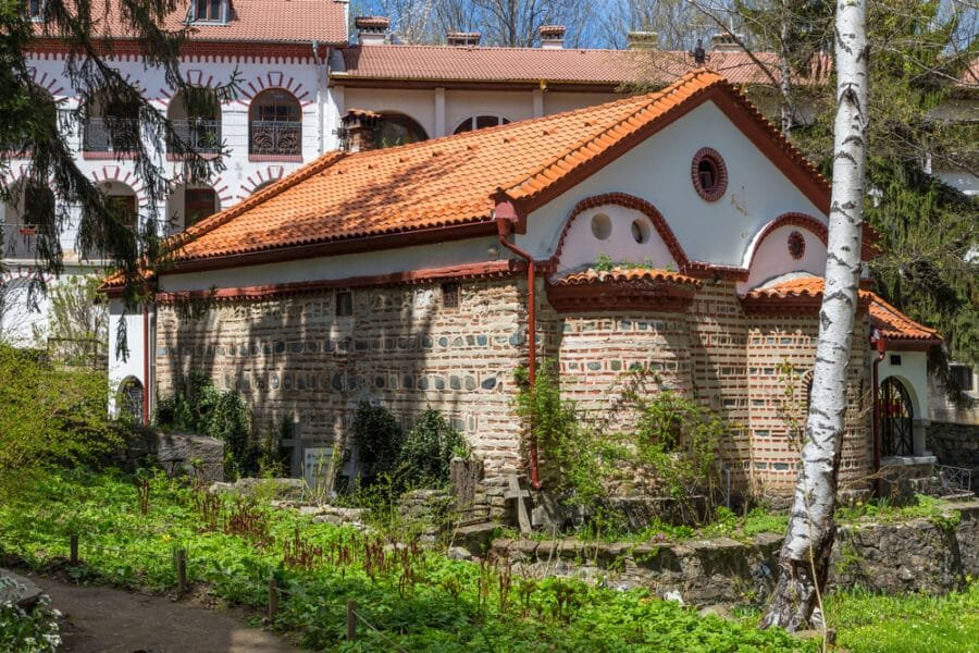
Finally, when exploring Vitosha Park, you can reach one more amazing monastery, the Dragalevtsi Monastery. Take the trail from the Dragalevtsi parish—it gains height following a paved path.
If you keep going, you will get to the beginning of a forest and follow the path that takes you further. After you cross the bridge, the course takes you directly to the monastery’s gates.
Emen Canyon
The Emen Canyon is found in the foothills of the Central Balkan National Park along the Negovanka River. Just 20 km from the city of Veliko Tarnovo, it makes for a great day trip for outdoor enthusiasts when visiting the city.
The river flows along limestone land, and over time, the water’s flow has changed the land so that many rapids, pools, and waterfalls can be seen along its course.
The canyon itself is made up of two sections – the Upper and Lower Boaz.
12. Ecological Trail Emen Canyon
The trailhead is near the town of Emen. The route was laid out in the 1980s, and hikers will discover wooden bridges, stairs, and other structures to make the trek more pleasant.
Along the trail, you will find a waterfall known as Momin Skok (Girls’ Leap), named after a legend about three young Bulgarian women who chose to throw themselves off the falls rather than be captured by the Ottomans. These secluded falls are stunning during the spring, measuring 10 meters high and enclosed on three sides by cliffs. A lovely pool beneath them makes for a refreshing place to take a quick dip!
Hikers will also find a paved road in Emen that leads to the Emen Cave, which was likely occupied as early as the Neolithic period. The cave was later used to grow mushrooms and support churns for cheese making during the socialist era and later still as a restaurant. Today, it’s home to multiple bat species and is open for visitors to explore.
Rhodope Mountains
Spread on a vast territory in Central Bulgaria, the Rhodope Mountains take a vast terrain and are subdivided into the western and eastern Rhodope.
Western Rhodope Mountains: Higher terrain and higher peaks, several gorges, and caves to explore.
Eastern Rhodope Mountains: Lower and less harsh, home to meadows, rivers, and ancient sites to visit.
13. Hiking Golyam Perelik
The highest peak in the Rhodope Mountains is Golyam Perelik, at 2191 meters above sea level. The peak is easy to hike as the terrain is relatively flat, shortening the climbing portions and making the overall walk more pleasant.
The trail begins at Perelik hut, and trekkers follow the red mark connecting to the actual hiking trail. This trail is a rocky pathway that goes straight up until reaching a fairly big meadow that hikers need to cross.
Once the meadow is over, you can admire Golyam Perelik. You can reach the gate of a military base at the top of the peak, but access is not allowed after that.
14. Hiking Orpheus’ Hills
This is an easy and relaxing hiking trail, perfect for enjoying the landscape and natural area of the mountains without stressing about getting lost or lacking skills. It is a good trail for beginners.
You don’t really need a lot of walking to reach Orpheus’ Hills, a dreamy place with a fairy tale atmosphere. It is considered the spot where Orpheus used to get inspiration for his songs. The trail starts just below Snezhanka Peak, following a well-marked path that is relatively flat and does not involve much climbing. Romantic and inspiring, this is a fantastic place to take a relaxing break from Sofia.
Devil’s Path Hiking Trail And Trigrad Gorge
Although the Rhodope Mountains seem to host the most accessible trails in the country, they are also home to the two most dangerous trails, which are only recommended to very skilled and advanced adventurers. Either on foot or by car, we do not recommend you take these paths with a light spirit—be prepared for a serious experience.
15. Devil’s Path Hiking Trail
This is considered among the country’s most dangerous hikes. It is an extreme trail with very narrow and hazardous stairways and high and impressive cliffs. The trail begins at the end of the parish of Borino–Katrandjiinitsata.
The trail can give you the wrong impression at the beginning, as it is soft and pleasant, but it soon becomes challenging once you reach the scary wooden stairways, with steep and narrow steps going through a small gorge. Fortunately, there are safe handrails that make the trail a bit easier.
The Devil’s Bridge marks the end of the trail. This natural formation was created by the river millions of years ago.
16. Trigrad Gorge
Considered the most dangerous roadway in Bulgaria, the gorge is a 7 km ravine with massive towering cliffs. The narrow passage was shaped by the River Trigrad millions of years ago.
This magnificent and deep gorge is awe-inspiring, but it can only be crossed by car, as there is no hiking trail.
However, the driving path tends to be very narrow in some areas, and extra careful driving is needed, especially at the bendiest parts or when it is time for two cars to face the same portion of the road, as sometimes there is not enough space. One of the cars needs to back up.
Which mountains in Bulgaria are popular for hiking?
In addition to Vitosha, Pirin, Rila, and the Rhodope Mountains, the Balkan Mountains, also known as Stara Planina, are a popular destination for hikers. These mountain ranges offer a diverse range of trails, stunning natural beauty, and unique cultural experiences.
What kind of hikes are available in Vitosha?
Vitosha Mountain, known for its easy access from Sofia, offers a variety of hikes, including the popular trail to the Black Peak. Visitors can enjoy lush forests, small waterfalls, and scenic routes. The area around Aleko Hut provides shorter day hikes and is a good starting point for beginners.
Are there challenging hikes in Pirin?
Pirin National Park, renowned for its rocky terrain and alpine meadows, offers some of the most challenging and rewarding hikes in Bulgaria. Koncheto Ridge, in particular, is a thrilling trail for experienced hikers, offering breathtaking views of the surrounding glacial lakes and rugged landscape.
What can I expect in Rila?
Rila, in addition to Musala Peak and the Seven Rila Lakes, boasts a network of well-marked trails leading to remote mountain huts and the famous Rila Monastery. The hikes range from moderate to challenging and traverse diverse landscapes, including lush meadows and dense forests.
What are some popular trails in the Rhodope Mountains?
The Rhodope Mountains are known for their gentle terrain and rich folklore. Trails like the path through Shiroka Laka and the route around the Smolyan Lakes are famous. Hikers can experience local legends and cultural trips in this region, which is rich in natural and historical significance.
What are the best times of year to hike in Bulgaria?
The best time of year for a hiking adventure in Bulgaria is late spring through early autumn. During these months, the weather is generally favorable, and the natural landscapes, from lush forests to alpine meadows, are at their most vibrant.
Are there any recommended cultural sites to visit while hiking?
Yes, Bulgaria’s hiking trails often lead to or are near significant cultural sites. The famous Rila Monastery is near Rila’s trails, the historical village of Shiroka Laka is near the Rhodope Mountains, and numerous ruins and fortresses are along the Balkan Mountains.
Can I find detailed trail maps or KML files for hiking in Bulgaria?
Detailed trail maps and KML files for Bulgarian hiking routes can typically be found online, with resources like Google Maps offering good guidance. Many local tourist information centers and guest houses also provide maps and trail advice.
What accommodations are available for hikers in Bulgaria?
Hikers in Bulgaria can find a variety of accommodations, ranging from mountain huts and guest houses to more luxurious hotels. Mountain huts are common along popular trails and offer basic amenities, perfect for an authentic hiking experience.
Are there any guided hiking tours available?
Yes, there are numerous guided hiking tours available in Bulgaria. These tours range from day hikes to multi-day treks and often include cultural trips, local guides, and sometimes even short transfers from major cities or train stations.
- Best Day Trips From Sofia
- Things To Do In Sofia
- Why You Should Visit Shumen
- Things To Do In Bulgaria
- Bansko Ski Resort
- Bulgarian Festivals
- Rent A Car Bulgaria
- Where To Stay In Sofia
- Best All-Inclusive Hotels In Bulgaria
- Most Beautiful Caves In Bulgaria
- Best Campsites In Bulgaria
- Where To Stay In Nessebar
Excellent post. Very helpful info thank you.
Bulgaria offers incredible hikingexperiences.